Understanding The Region
Warren County is defined by several different environments, each largely isolated from the next by terrain, road access, and dramatic mountains and scenery.
Through each of them you will find crystal-clear waters, wildlife in abundance, and extensive opportunities to experience a taste of a slower, more rewarding pace of life.
Much of the area has limited access along narrow two-lane roads, with the I-87 interstate running north through Queensbury and Lake George, past Warrensburg and north along the Schroon River.
Please be aware that travel in the Adirondacks is fine most of the time, but weather conditions can change rapidly. Be particularly aware that travel during late fall and winter in particular is affected by something you may not be aware of: elevation. The higher you go the colder it’s likely to be and the deeper the snow. A gentle rain near Queensbury may be freezing rain before you reach Warrensburg and deep snow by the time you get to Indian Lake or Lake Placid, so be careful to take that into account in your travels.
Here is a brief overview of the unique flavors of the different environments here as we start at the 418 bridge over the Hudson River and proceed in a generally clockwise tour of the county.
The Upper Hudson Corridor
 The upper Hudson corridor of Warren County feels less like a destination and more like a quiet passage into the Adirondack backcountry. Starting from the 418 bridge with Sugarloaf Mountain and the 3 Sisters Mountains, you immediately pass the confluence of the Hudson and Schroon Rivers.
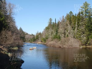
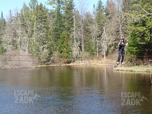
The Hudson River now becomes defined by gravel bars and whitewater where you’ll frequently see whitewater rafters, and as the season become warmer and calmer, tubers as well. Follow it north from Thurman and Warrensburg through The Glen, Riparius, North Creek, and North River. There are no navigable stretches here. As you travel, the river climbs quickly into deep mountain wilderness.
This environment is defined by dense forests, narrow valleys, and long views of Adirondack peaks. Here the Hudson is young and energetic—clear, fast-moving, and edged with gravel bars, white pine groves, rocky channels and whitewater. 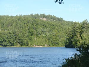 In most places, the river runs through narrow gaps between forested ridges, giving the corridor a sense of movement and quiet drama.
Water events happen quickly here, with the river rising and falling relatively rapidly as snows melt and rainstorms pass through. Ice-out on this river can be dramatic, with huge ice flows scouring riverbanks and creating thunderous roars when they occur.
The main north-south highway through the area is Route 28, beginning just north of Warrensburg and continuing past Indian Lake, while Route 8 is the narrow winding two-lane east-west highway that brings travelers from Chestertown west through Wevertown, Johnsburg, and Bakers Mills on to eventually reach Speculator. While a few spur routes such as 28N and 418 offer access to nearby areas such as Athol, Minerva, and Olmstedville, it’s really 28 and 8 that define the area.
All main highways here are two-lane roads with frequent tight curves and long stretches of no-passing zones. 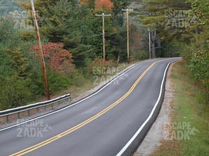 Views from the roads are frequently breathtaking, and numerous small trout streams cross the roads. In the winter snowstorms can make many of these roads briefly impassable, but this is an area deeply experienced with snow; it usually doesn’t take long to clear the roads.
The atmosphere is rural and unhurried, and if there’s any impatience here, it’s usually simply due to wanting the snow to melt in the spring.
Warrensburg serves as the southern gateway, offering services and a stronger village center before you transition south toward Lake George and the Capital Region.
In the northern reaches of Warrensburg, the character shifts. Away from the village center, the town stretches into 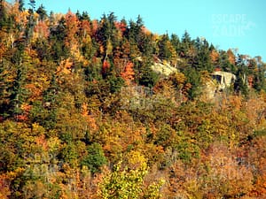 large, sparsely populated tracts where old logging roads, conservation lands, lakes and ponds, and rugged terrain create secluded areas. These lands feel quiet and almost hidden, where distance, elevation, and limited access preserve a strong sense of privacy and wilderness edge.
Thurman’s scattered maple farms and homesteads reflect a long agricultural tradition.
Riparius feels almost hidden—more a glimpse than a town—where the forest presses close and traffic is sparse.
Johnsburg spreads across mountains and hamlets, where seasonal camps and year-round locals lend a resilient, independent character.
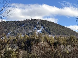
North Creek provides the corridor’s small northern hub, with its proximity to the ski center at Gore Mountain and a walk-able main street that balances outdoor recreation with a modest arts and dining scene.
What ties the entire area together is a feeling of space and authenticity. Nights are dark and quiet. 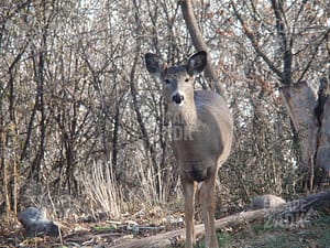 Cell service fades in most places. Wildlife is common. Life follows the seasons—spring runoff, summer river days, brilliant fall color, and long, snow-filled winters.
The upper Hudson corridor isn’t polished or crowded. Its appeal lies in its landscape, strong local identity, and deep connection to forest, river, and mountain—a place where the Adirondacks begin to feel expansive, personal, and very real.
Western Highlands
 Tucked away in the northwest part of the county are the Western Highlands, a remote area largely consisting of Wilderness areas such as the Siamese Ponds Wilderness and the Wilcox Lake Wild Forest, areas that span over 200,000 acres, much of it across Johnsburg, Thurman, and Stony Creek.
This region is defined by elevation, remoteness, and deep, unbroken forest. Here it feels like the Adirondacks before roads, resorts, and tourism shaped the landscape.
In this region the terrain rises into mountain ridges, hidden valleys, and quiet uplands. Streams tumble through narrow hollows, feeding small ponds and wetlands tucked between wooded slopes. Unlike the river-centered communities to the east, the Western Highlands feel inward and elevated, where views often come from rocky 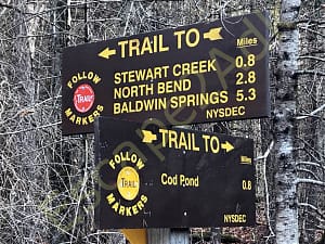 peaks and jagged ledges rather than valley floors.
The atmosphere is quiet, rugged, and self-reliant. In Johnsburg this area is characterized by long stretches of uninhabited forest, while in Thurman and Stony Creek’s western reaches, occasional homes are scattered along winding roads that climb into the hills, often ending at seasonal camps. Trails crisscross the region, often stretching for miles and frequently connecting with other trails in the midst of the wilderness, sometimes with a nearby campsite.
Stony Creek reflects the character of a true mountain town—small, resilient, and closely tied to the surrounding forest, with a long tradition of hunting, and outdoor life.
 While Route 8 crosses through the northern side of the highlands, most other roads are small local roads often recognized more by a name rather than a number, and frequently telling where the road originates: Warrensburg Road, Hadley Road, South Johnsburg Road.
The public lands define the region’s identity. The Siamese Ponds Wilderness offers a rare sense of solitude, where foot travel is the only way in, drones are banned, and natural sounds replace human noise. Nearby, the Wilcox Lake Wild Forest provides another network of trails, remote lakes, and scenic high points, offering a strong backcountry feel.
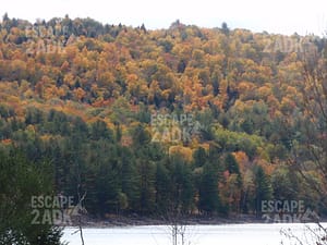
Life here follows the rhythms of weather and season. Spring brings muddy roads and rushing streams. Summers 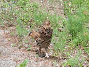 are cool and green, with long days for hiking and paddling quiet ponds. Autumn arrives early with sweeping color across the ridges. Winters are long and snowy, when snowmobiles, skis, and woodstoves become part of daily life.
What defines the Western Highlands is a sense of distance—from crowds, from noise, and from urgency. It’s a landscape shaped more by forest and elevation than by towns, where the horizon is mountains, the nights are dark, and the Adirondack wilderness feels close, constant, and deeply personal.
Schroon River Corridor
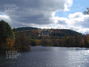
 Moving east from the Upper Hudson River Corridor we find ourselves in a more settled region. The Schroon River corridor offers a gentler side of the Adirondacks—one shaped by water, open valleys, and a long tradition of small-town life. The river flows south from Schroon Lake through Pottersville, Horicon and Chestertown and on to Warrensburg and the Hudson River. The Schroon winds through a landscape of oxbows and elbows past meadows, wetlands, forested hills, and quiet mountain backdrops.
Here, the environment feels balanced and livable. The Schroon moves at an easy pace, widening into calm stretches ideal for paddling, fishing, and summer swimming intermixed with gentle rapids and trout waters. Along its banks, you’ll find a mix of historic homes, family camps, working properties, and conserved land, all set within a valley that feels open without ever losing its connection to the surrounding Adirondack wilderness.
 The effect of wetlands and the reservoir of Schroon Lake make spring seem to last longer here as sloughs, marshes, and the lake slowly give up the waters that they absorb when everything is wet.
The atmosphere is relaxed, neighborly, and rooted in the seasons. Chestertown is the corridor’s central hub—close to both the river and Schroon Lake, with local shops, community events, and easy access to trails and public lands. Horicon feels quieter and more residential, where the valley narrows and the forests lie close to the road, while at the southern end Warrensburg serves as the southern gateway, a place where two village centers and year-round services meet a strong outdoor culture.
Unlike the higher mountain regions, the Schroon River corridor feels accessible and welcoming; with a landscape 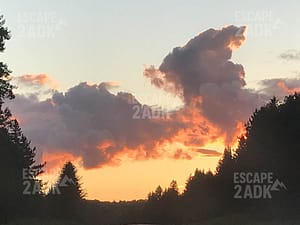 that supports everyday life as easily as recreation. Summers bring tubing, farmers markets, and long evenings by the water. Autumn settles in with warm light across wetlands and hillsides of color. Winters are snowy but manageable, with a steady rhythm of year-round residents alongside seasonal homeowners who return for peace and simplicity.
What defines the Schroon River corridor is its sense of ease. The mountains are always in view, the river is never far away, and the pace of life feels steady and grounded. It’s an Adirondack landscape that blends natural beauty with community, offering space, quiet, and a strong feeling of finally being home.
Eastern Highlands
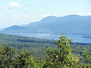
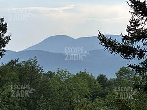 The Eastern Highlands of Warren County sit above the western shore of Lake George, where mountain ridges, clear lakes, and dramatic overlooks create one of the region’s most scenic and distinctive landscapes. Stretching east from Brant Lake and Horicon through Hague and south toward Bolton, this area is defined by elevation, water, and sweeping views across the narrow northern basin of Lake George.
The terrain here feels both rugged and refined. Forested mountains climb steeply from the shoreline, forming the Tongue Mountain Range and a network of smaller ridges that hold quiet ponds, rocky summits, and miles of protected forest. Brant Lake offers a calmer lake setting and the mountains frame a quieter, more residential lake environment.
Only a single highway penetrates this region in the north. Route 8 follows a winding up-and-down course that climbs from the lake area around Brant Lake  through the highlands near Swede Mountain, and then drops rapidly along a steeply winding route down to Hague and Lake George, which brings expansive water and offers ever-changing light. Plan to take your time on this scenic road, and be cautious when considering a winter trek here; conditions in the heights may vary wildly from those by the lakes.
The atmosphere is peaceful, scenic, and seasonally vibrant. Hague, set just above the Lake George Narrows, sits beside one of the most tranquil stretches of the lake. It feels intimate and unhurried: a small hamlet tucked between water and mountain slopes.
From the northeast, Route 9N follows the lake shore south from Ticonderoga and skirts the eastern and southern  sides of the highlands through Hague and Silver Bay. It then climbs steeply and cuts briefly across the Tongue Mountain Range.
Several trails run through the Tongue Mountain Range, and many lead to dramatic overlooks. Quiet bays, inlets, and lesser-known access points offer paddling, swimming, and shoreline solitude away from the busier southern areas of the lake.
On the southwest side of the range, Route 9N drops back down to rejoin Lake George at Northwest Bay.
Life in the Eastern Highlands follows the rhythm of the seasons. Summers are bright and active. Autumn brings early color across the ridges and clear, far-reaching views. Winters settle in quietly, with snow-covered mountains and a slower pace that emphasizes small-community roots.
What defines the Eastern Highlands is a sense of vertical beauty and quiet distinction—where mountains meet deep water, development gives way to preserved shoreline, and the northern reaches of Lake George feel expansive, scenic, and deeply connected to the surrounding Adirondack wilderness.
Lake George Basin
 The Lake George Basin, stretching south from Ticonderoga past the quiet narrows below Hague and on past Bolton, Diamond Point, and into Lake George Village, is where the mountain scenery of the Adirondacks meets open water and a long tradition of lakeside life. Here, the landscape seems towiden and becomes more active, yet remains framed by steep forested slopes, island-dotted water, and the unmistakable clarity of Lake George.
The environment is shaped by the lake itself. The shoreline alternates between protected coves, rocky points, public beaches, and historic camps tucked among the trees. The Tongue Mountain Range reaches a long finger deep into Lake George, while ridges and wooded hills define the western horizon.
Following Route 9N south along the lake from Hague leads you to Bolton, a livelier village center, blending 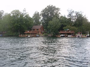 marinas, shops, and dining with public beaches and island-dotted views across the lake.
The atmosphere is vibrant yet layered, shifting from peaceful mornings to lively summer afternoons. Bolton Landing offers a classic Adirondack lakeside resort village, with marinas, shops, and waterfront dining balanced by easy access to trails and quiet bays.
Just south, Diamond Point feels more residential and relaxed, where year-round homes and cottages line wooded roads close to the water.
In the central basin, the lake opens into broad stretches of water, where light, weather, and season constantly change the mood.
 Throughout this stretch of lakeshore, public lands and conserved shorelines help preserve a strong sense of openness centered on boating and lake life.
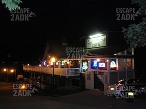
At the south end of the lake, Lake George Village becomes the region’s tourist hub—energetic, walk-able, and centered on tourism, boating, and seasonal events. Yet even here, the mountains remain close, and just beyond the village the shoreline returns to wooded stretches and quieter neighborhoods.
As does the entire region, life in the basin revolves around the seasons, but here that life also revolves around the lake. Summer brings boats, island camping, swimming, and long evenings on the water. Autumn softens the pace, with brilliant color climbing the surrounding hills and clear, quiet days on the lake. Winter transforms the area 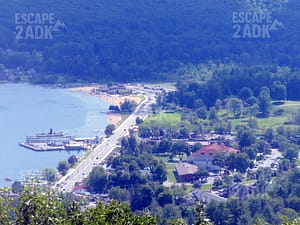 again, as crowds fade and the region settles into a slower rhythm of year-round community life.
What defines the Lake George Basin is its dynamic balance—natural beauty paired with activity, mountain wilderness alongside village energy, and a shoreline that offers both excitement and refuge. It’s the heart of the southeastern Adirondacks, where the lake sets the tone and the landscape invites people to gather, explore, and return.
Southern Metro
The southern metro area of Warren County—centered on Queensbury and Glens Falls—forms the region’s cultural and economic heart, where Adirondack foothills meet small-city energy and everyday convenience. This is the transition zone between mountain country and the Capital Region, offering walk-able neighborhoods, neighborhood lakes, established services, and a strong sense of year-round community.
The landscape here is gentler than the northern towns, shaped by rolling terrain, mature tree cover, and the Hudson River as it begins to widen and slow. In Glens Falls, historic streets, brick architecture, medical facilities, and compact neighborhoods create a traditional city feel, along the north side of the Hudson River while Queensbury spreads outward across residential areas, commercial centers, and quiet suburban pockets set against wooded ridges.
The atmosphere is active, connected, and community-focused. Downtown Glens Falls serves as the cultural center, with local restaurants, galleries, theaters, and year-round events that bring energy to the streets. Crandall Park provides green space at the city’s edge, blending pools of water, open lawns, and shaded trails that reflect the area’s long civic history.
Queensbury complements the city with convenience and accessibility. Shopping districts, schools, and recreation centers make it a practical hub for daily life, while nearby trail systems, lakes, and ski areas keep outdoor opportunities close at hand.
Life in the southern metro area moves at a steady pace. Commuters connect easily to surrounding counties and the Capital District via I-87 and several local highways while residents enjoy a balance of urban amenities and Adirondack proximity. Summer brings concerts, farmers markets, and community festivals. Autumn colors the neighborhoods and nearby hills and the Adirondack Balloon Festival provides a unique viewpoint for this dramatic scenery. Winter offers quick access to West Mountain skiing and snow recreation, followed by a return to warm cafés and neighborhood routines.
What defines Queensbury and Glens Falls is their role as a gateway and anchor—places where people live, work, and gather, with the mountains always just up the road. It’s a setting that combines practicality with character, offering stability, culture, and a strong sense of place at the southeastern edge of the Adirondacks.
Hudson Corridor
 Following the Hudson River west we enter the lower Hudson corridor. This marks the transition from the developed southern gateway of Warren County into the quieter, more rugged Adirondack interior. Moving west from the edges of Queensbury and Glens Falls the river cuts through the mountains and then turns north through Lake Luzerne, Stony Creek, Thurman, and up to Warrensburg. The landscape becomes increasingly defined by river bends, narrow valleys, and the steady return of forest and mountain solitude.
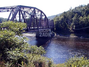
Again as in so many areas here, a single main road, Corinth Road – Route 28 – leads us from Queensbury across the heights to Corinth. There we cross the river and rejoin our old friend 9N north through Lake Luzerne, where the Sacandaga River roars in and the river between Lake Luzerne and Hadley is emphasized by the dramatic Rockwell Falls.
 Here, the Hudson is lively and expressive. The river flows through deep waters that draw boaters, rafters, paddlers and anglers alike, while wooded shorelines create long stretches of quiet along its course.
The surrounding terrain rises into low mountains and long forested ridges, where homes thin out and the natural landscape begins to dominate.
The atmosphere is rural, independent, and deeply connected to the land. Lake Luzerne serves as a small hub, known for its rafting outfitters, lakeside camps, and summer arts traditions. From there, Stony Creek and Thurman feel remote, with scattered homes, seasonal cabins, and winding roads that climb into forests, farms, and mountain valleys.
 Now, as we near the 418 bridge, we come full circle, re-entering regions of gravel bars and shallows that can often be walked across when the water is low, intermixed with scattered swimming holes and tumbling mountain brooks..
Life along the lower Hudson follows the river and the seasons. Spring brings high water and the sound of rushing current. Summers are active but never crowded, with rafting, swimming, and long green evenings. Autumn settles in with deep color along the valley walls. Winters are quiet and snowy, when travel slows and the landscape returns to stillness.
What defines the lower Hudson corridor is its gradual deepening into the Adirondacks—a place where development fades, the river leads the way, and each mile north feels more spacious, more private, and more connected to the wild character of Warren County’s interior.
Please support our Sponsor:
(click to visit)